Categories
mountain

Arkhangai

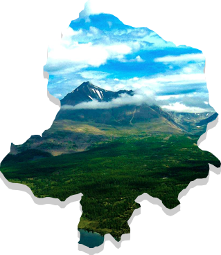
he Arkhangai Province was originally established in 1923 under the name of Tsetserleg Mandal Uul Province, but was changed to Arkhangai Province in 1931. The province covers an area of 55,300 km2 and has an average altitude of 2,414 meters above sea level. The highest point is Kharlagtai Peak at 3,539m while the lowest point is the area on the confluence of the Orkon and Tamir rivers at 1,290 m.

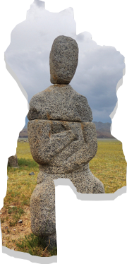
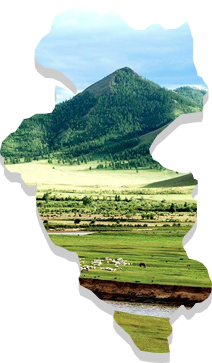
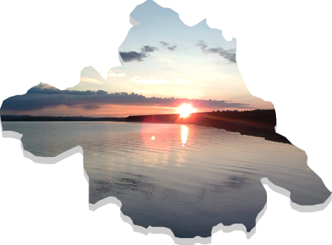
The province is divided into three geographical zones: high mountain, forest steppe and steppe. It borders with Khuvsgul Province to the north, Bulgan Province to the east, Uvurkhangai Province to the south, Bayankhongor Province to the west and Zavkhan Province to the north-west. The province is an important area for tourism, with natural attractions including the Terkhiin Tsagaan Lake, Ugii Lake and the volcano landscapes Khorgo and Taikhar Chuluu.

The average annual temperature of Tsetserleg city is 0.10C, with a monthly average of -15.60C in January during the winter and 14.70C in July during the summer time. The Khangai mountains area has one of the highest precipitation levels in Mongolia, with average annual precipitation in Tsetserleg city of 344 mm. Average wind speed is 2.6 m/sec with a high of 3.5 m/sec in the month of April.

Categories
mountain

Bayankhongor

Bayankhongor Province was established by the Resolution #81 of Consultative State Meeting on 11 December 1941. It contains 16 soums, 112 bags, 11,800 households and a population of 41,800. With an area of 116,000 km2, it is one of the largest provinces in area, accounting for some 7.8 percent of the total territory of Mongolia. This includes four geographical zones: Altai, Khangai, Gobi desert and steppe. Bayankhongor Province is located in the central western part of Mongolia, at the transition from the Great Siberian taiga to the Central Asian Gobi desert. It borders with the Uvurkhangai, Umnugobi, Gobi-Altai, Zavkhan, and Arkhangai provinces and also share a 140km border with China. The center of the province is located 630 kilometers away from the capital, Ulaanbaatar.

The northern part of the province includes the plateau of southern Altai Mountains and forest steppe, the middle region includes the Great Lakes and steppe, while the southern part includes the Gobi desert zone. The province is known for its high capacity for solar and wind energy resources, despite harsh weather conditions ranging from the cold and wet weather of the north to the extreme dry conditions of the south. The majority of territory has an elevation of 1000-1400 m above sea level, with the lowest point, Ekhiin-Gol, located at the altitude of 720 m and the highest point, Ikh Bogd Mountain at the altitude of 3,957 m. Average temperature range is around -18 to 300C during the winter time and around 15 to 270C during the summer time.

The province is rich in minerals such as gold, copper, brown coal, crystal, spar, marble, granite and precious stone as well as construction materials like various soil paints, high quality mud and limestone.

Categories
mountain

Bulgan

The Bulgan Province was established in 1937 after a separation of certain areas from the Selenge Province. The province has 15 soums, a population of 43,500 and 1.1 million animals.

Located in central-northern Mongolia, the province share a 290km border with Khuvsgul Province, a 250km border with Arkhangai Province, a 30km border with Uvurkhangai Province, a 230km border with Tuv Province, a 220km border with Selenge Province and Orkhon province. It is also shares a 170km border with Russia. The province has harsh continental weather, an average annual temperate of 1.50C and annual average precipitation of 242.9 mm.

Bulgan city is the capital of the province and is located 318 km far away from Ulaanbaatar.

Seasonal difference In the winter there are often clear skies, cold but stable temperatures, low snowfall and weak wind speeds. Temperatures can reach -460C, typically in the month of January. Wind speeds are around 1.9 to 2.5 m/sec from the northern west. In the spring, the weather becomes moreunstable, with warm daytime temperatures and cold nights. There is also ahigh frequency of dust storm. In the summers, temperatures can reach as high as 40.50C. In autumn, there is a high variance temperature (to a lesser extent than spring). Unstable weather conditions and increase in wind strength in summer times.

Categories
mountain

Orkhon

This province was originally established as a federal municipality of Bulgan province in 1974 with the name of Erdenet Khoroo. This area would later be split from Bulgan Province and established as its own province in 1994 with a capital city Erdenet.

Orkhon Province is located in the central north of Mongolia and borders with Selenge and Bulgan provinces. It is has an average elevation of 1,200 meters above sea level and has an area of 844 km2.

Around 502 km2 of total territory is agricultural land, 251 km2 is city and settlement area, and the remaining area forest land. From agricultural land, around two-thirds are for crop fields and one-third is for pasture lands.

The province has harsh weather condition. Temperature can reach as low as -200C during winter and 300C during summer time. The annual average temperature is +0.80C and average precipitation is 371.8 mm in a year with high rain and snow fall. April and May are the windiest months, January is the coldest and July is the hottest month of the year.

Orkhon Province has two soums: Bayan-Undur and Jargalant, and these soums have 22 bags.

There are a total of 26 hotels with more than 300 beds and 9 recreational and tourism camps with the capacity of serving over 400 people in Erdenet city. In addition, there is “Mongol Urtuu” tourist network comprising of total 25 tourist camps and tour-operators in the Orkhon, Khuvsgul and Uvurkhangai provinces.

Categories
mountain

Uvurkhangai

The central geographical point of Mongolia is at the front side of Ongon Mountain, Burd soum, contained within the Uvurkhangai Province. The province is predominantly steppe in the central region, with the Branch Mountains of the Altai range and sandy steppe in the southern part, and with the branch mountains of the Khangai rabge in the northern part.

Since the province is divided into three distinct zones, it is rich with natural resources. There are plenty of high mountains and hills with elevations between 2,000-3,590m such as Khyatruun, Bituut of Khangai range, Bagabogd and Myangan Yamaat of Mongol-Altai range. Other highlights include the 24 meter high waterfall of Orkhon river named “Ulaan Tsutgalan”, the unique Khuisiin Naiman lakes and Tamchiin Yol Cliffs at an elevation of 2,500m above sea level. This as well as impressive steppes such as Arvaikheer, Shagj, Doloodoi, Khongor, Guchingiin Tal and Orkhon Valley lie in this province.

The northern part of the province contains the Branch Mountains of the Khangai range whereas the southern part is predominantly the steppe. The Bagabogd and Artsbogd mountains are found in this region. The central and northeastern parts of this province have an Early Mesozoic Era sandy stone and hornstones, while the southwestern part has Cretaceous Period moraines.

Rivers like the Orkhon, Ongi, Taats and Ar Agui flow through the Uvurkhangai Province. Large lakes like Ulaan Tsutgalan, Naiman Nuur and Taatsyn Tsagaan and numerous springs like Khujirtyn, Mogoit, Khyatruun, Khuremtiin, Taats, Mustiin, Khuren Khad, Khorkhoi Turuu and Takhiin, all belong to this province.

According to geological research, 4 gold deposits and 10 further detections have been established in this province, as well as 9 precious metal, 4 nonferrous metal, 2 iron ore, 4 mineral paint, one salt deposit and 12 construction material resource deposits.

Categories
mountain

Khuvsgul

Khuvsgul Province was established in 1931 and the name is derived from Lake Khuvsgul located within the area. It borders with Bulgan, Arkhangai and Zavkhan provinces, and also borders with Russia. Its capital Murun is located 671 km away from Ulaanbaatar. The province contains 24 soums and furthermore 126 bags in accordance with the constitution set in 1992. Total territory is 100.629 km2, and it is the sixth largest province in Mongolia in terms of geographical area. The province is dominated by the mountains and is rich in flora and fauna, mineral resources, abundant in historical and natural places, and a home to an untouched natural environment.

It is located in the Khangai Mountain Region. The major mountains are Khuvsgul Tagna and Sayan Mountains which belong to the Khangai Mountain range. The highest point of the province is the Delgerkhaan Mountain at 3,491m above sea level and the province has an average elevation of 1,650-2,050 m above sea level.