Categories
gobi

Dornogovi

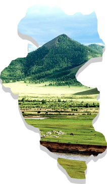
This province is located in the southeast of Mongolia and share borders with the Umnugovi, Dundgovi, Govisumber, Khentii and Sukhbaatar provinces. The capital of the province is the city of Sainshand. Much of Dornogovi is located in the steppe of southeastern Mongolia. Despite this there are a number of mountain ranges including, Khutag (1,431 m), Otsol, Sansar, Ikh Bagadulaan, Argalant, Khan Bayanzurkh and Khairkhan (1,031 m).

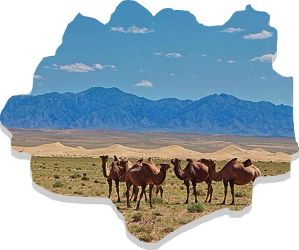
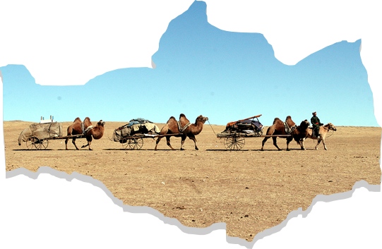
The province is contained entirely within the Gobi zone and has an area combined with Gobi desert and steppe. It has harsh weather conditions, with temperatures reaching up to +410C during summer time and falling to -400C during winter time. Average wind speed is around 4.2 to 4.6 m/sec with occasional extremes of up to 35 m/sec.

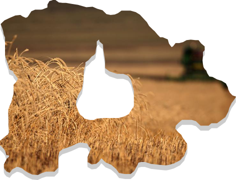
Much vegetation can be found in this province. Black-tailed gazelles, Mongolian wild ass, Siberian ibex and mountain sheep are common. There are no large lakes or rivers in Dornogovi, instead there are many underground water resources. Mineral springs such as Khalzan Uul, Busiin Chuluu and Toli Bulag are located in this region. The major part of territory contains Gobi brown soil, and there are significant amounts of sand as well.

https://mn.wikipedia.org/wiki
Categories
gobi

Dundgovi

Dundgovi Province was established in 1941 under the name of Sharangad Province with total 18 soums. Of these, eight were transferred from Umnugovi Province, three from Dornogobi Province and 7 from Tuv Province. In 1942, the name was changed to Dundgovi, and the center of the province was moved to its current location Mandalgovi.

Dundgovi Province now has 15 soums, 66 bags and an area of 74,690 km2. It accounts for 4.5 percent of total territory of Mongolia. The capital Mandalgovi is located 265 km from Ulaanbaatar, and it shares borders with Tuv, Govisumber, Dornogovi, Umnugovi and Uvurkhangai provinces.

With a total border of 1,230 km, at its widest it is 425 km (Guchin Khudag to Khukh Del) and height north to south (Us Khar Hill to Uvur Tsagaan Ders) is 283 km. The territory contains steppe and Gobi desert zone. The highest point in plain steppe is at an elevation of 1,530 meters above sea level while the lowest point is 980 meters. The highest mountain – Delgerkhangai is 1,913 m. Mountain soil (dark brown, brown and light brown colored soil) is contained in a very small section of the province, found in the northern side of Adaatsag, Baga Gazriin Chuluu, Ugtaal Mountain and Ikh Gazriin Chuluu. The northern and central parts have hillocks and mound types of soil (brown, light brown, desertous steppe umber and Gobi-gray soil). In the southern and central parts, valley-type soil (20 types of soil from desert steppe) is widely found.

https://mn.wikipedia.org/wiki
Categories
gobi

Umnugovi

Umnugovi Province has a total area of 165,300 km2, containing 15 soums and 58 bags. The capital of the province is Dalanzadgad.

Umnugovi is the largest province in the country in terms of geographical size. The area is predominantly Gobi desert and has an average elevation ranging around 1,300-1,600m above sea level. There is however some continuance of the Altai Mountain range, with mountains of 3000m + elevation like Govi Gurvan Saikhan, Sevrei, Noyon Bogd, Nomgon, Tost, Nemegt, Altan Uul, Gilbent, and 100km long Khongor sand dune and couple dozen km vast Gobis like Galba, Borzon, Zeemeg, and Zag Sujiin.

The area has many springs such as Khadat, Nemegt, Zuulun, Enger Buleen and Talkhit cold springs, and the Elgen and Salkhit hot springs.

The steppe area in this province is rich in mineral resources like lead, copper, iron ore, marble, alabaster, feldspar and crystals. The province contains the Tavan Tolgoi deposit which holds several billion tons of high quality coal.

The province has extreme weather conditions. Temperatures range from -20 to 300C during winter and 30 to 380C during summer. The wind speed is 5 to 15m/sec with occasional bouts of 34 to 35m/sec.

https://mn.wikipedia.org/wiki
Categories
central

Gobisumber

By Resolution of the Consultative State Meeting on 21 June 1991, the city of Choir city was established as an integration of the Sumber and Shiveegobi Khoroos of the Dornogovi Province and the Bayantal Khoroo of Ulaanbaatar city. Subsequent to this, the Gobisumber Province was established on 6 May 1994. This Province surrounds the immediate area of Choir and is located 250 km south east of Ulaanbaatar.

The province shares borders with the Tuv Province to the north, the Khentii Province to the east and north east, the Dundgovi Province to the west and the Dornogovi Province to the west and south west. It has an area of 5,500 km2.

In meteorological terms, it experiences harsh continental weather, due to its combination of Gobi-desert and steppe environments. It is located at the altitude of 1,000-1,200 meters above sea level. Annual precipitation of Govisumber Province is higher than Gobi zone (200-250 mm in average) and has a temperature range of 370C in summer to -370C in winter. Govisumber Province is rich in mineral resources such as coal, mud for brick, mineral paint, fluoride, limestone and graphite.

https://mn.wikipedia.org/wiki
Categories
central

Darkhan-Uul

Darkhan-Uul Province has an area of 3,275 km2, covering the north-east valley of Kharaa River between branches of the Khentii Mountains in the northern part of Mongolia.

Despite its small geographical size, the province is rich in natural resources such as gold, limestone, coal and various types of raw materials used for construction products. It has an an average elevation of 707m and is thus located in relatively low area. Rivers including the Zulzaga, Shariin gol, Yuruu, Orkhon, Khuiten, Khavchuun and Kharaa river pass through the territory of this province, due to the Khentii Mountains and drain into Orkhon River.

Maximum temperature in the province is 42.60C in July and the minimum temperature is -43.7 0C in January. Annual average precipitation is 310 to 320 mm, of which, 85-90 percent or 284-290 mm of precipitation falls during the warmer months.

https://mn.wikipedia.org
Categories
central

Selenge

Selenge Province was established in 1934. It is located in northern Mongolia, between the Orkhon and Selenge river basins and is predominantly forest steppe region with hills and mountains. Jurassic era sediment deposits are spread throughout the northwest, granite is found throughout the south, and metamorphic granite throughout the north of the province. Selenge Province is rich in mineral resources such as coal (Ulaan Tolgoi, Sharyn Gol etc), iron ore (Tumurtei, Tumur Tolgoi), gold (Ikh Altat, Bugant, Tolgoit) and construction raw materials.

The large rivers of Mongolia such as Selenge, Orkhon, Yuruu and Kharaa flow through this region. There are also many lakes like Tsagaannuur and springs such as Yuruu, Tovkhonkhany, Khondyn, Mogoin. Most of the region has mountainous dark soil with some sediment soil in the river valleys. It is surrounded by Tavan Khan Mountain.

42 percent of the provinceincial territory is covered by forest and the remaining parts are covered by pasture plants. Rivers basins are covered by bushes. Forest and steppe animals are widely spread.

Categories
central

Tuv

The administration of this province was belonged to Ulaanbaatar between 1931-1942, however, this was changed to the current capital, Zuunmod in 1942.

Most of the territory of Tuv province has mountainous landscape, namely, the Khentii Mountain range at an elevation of 1,200 to 1,500m (the highest peak is Asralt Khairkhan at 2,800m). A total of 16.4 percent of all territory is forest, while 36.5 percent is steppe area.

The area of Tuv Province is considered as part of the Khentii-Khangai Mountain range and eastern Mongolian plains. The northern part of the province is covered with brown soil that is suitable for agriculture and in the southern part lays plains with small hills and mounds. There are more than 30 large and small rivers like Kherlen and Tuul. Also, there are springs such as Janchivlan, Tsaidam and Tsakhir.

16 species of endangered animals including deer, doe, moose, Argali –wild sheep, snowcock, swan etc. inhabit the area. About 30 different species of game animals like the squirrel, fox, marmot, steppe fox, boar, bear, and lynx also live in the area.

Categories
mountain

Arkhangai

he Arkhangai Province was originally established in 1923 under the name of Tsetserleg Mandal Uul Province, but was changed to Arkhangai Province in 1931. The province covers an area of 55,300 km2 and has an average altitude of 2,414 meters above sea level. The highest point is Kharlagtai Peak at 3,539m while the lowest point is the area on the confluence of the Orkon and Tamir rivers at 1,290 m.

The province is divided into three geographical zones: high mountain, forest steppe and steppe. It borders with Khuvsgul Province to the north, Bulgan Province to the east, Uvurkhangai Province to the south, Bayankhongor Province to the west and Zavkhan Province to the north-west. The province is an important area for tourism, with natural attractions including the Terkhiin Tsagaan Lake, Ugii Lake and the volcano landscapes Khorgo and Taikhar Chuluu.

The average annual temperature of Tsetserleg city is 0.10C, with a monthly average of -15.60C in January during the winter and 14.70C in July during the summer time. The Khangai mountains area has one of the highest precipitation levels in Mongolia, with average annual precipitation in Tsetserleg city of 344 mm. Average wind speed is 2.6 m/sec with a high of 3.5 m/sec in the month of April.

Categories
mountain

Bayankhongor

Bayankhongor Province was established by the Resolution #81 of Consultative State Meeting on 11 December 1941. It contains 16 soums, 112 bags, 11,800 households and a population of 41,800. With an area of 116,000 km2, it is one of the largest provinces in area, accounting for some 7.8 percent of the total territory of Mongolia. This includes four geographical zones: Altai, Khangai, Gobi desert and steppe. Bayankhongor Province is located in the central western part of Mongolia, at the transition from the Great Siberian taiga to the Central Asian Gobi desert. It borders with the Uvurkhangai, Umnugobi, Gobi-Altai, Zavkhan, and Arkhangai provinces and also share a 140km border with China. The center of the province is located 630 kilometers away from the capital, Ulaanbaatar.

The northern part of the province includes the plateau of southern Altai Mountains and forest steppe, the middle region includes the Great Lakes and steppe, while the southern part includes the Gobi desert zone. The province is known for its high capacity for solar and wind energy resources, despite harsh weather conditions ranging from the cold and wet weather of the north to the extreme dry conditions of the south. The majority of territory has an elevation of 1000-1400 m above sea level, with the lowest point, Ekhiin-Gol, located at the altitude of 720 m and the highest point, Ikh Bogd Mountain at the altitude of 3,957 m. Average temperature range is around -18 to 300C during the winter time and around 15 to 270C during the summer time.

The province is rich in minerals such as gold, copper, brown coal, crystal, spar, marble, granite and precious stone as well as construction materials like various soil paints, high quality mud and limestone.

Categories
mountain

Bulgan

The Bulgan Province was established in 1937 after a separation of certain areas from the Selenge Province. The province has 15 soums, a population of 43,500 and 1.1 million animals.

Located in central-northern Mongolia, the province share a 290km border with Khuvsgul Province, a 250km border with Arkhangai Province, a 30km border with Uvurkhangai Province, a 230km border with Tuv Province, a 220km border with Selenge Province and Orkhon province. It is also shares a 170km border with Russia. The province has harsh continental weather, an average annual temperate of 1.50C and annual average precipitation of 242.9 mm.

Bulgan city is the capital of the province and is located 318 km far away from Ulaanbaatar.

Seasonal difference In the winter there are often clear skies, cold but stable temperatures, low snowfall and weak wind speeds. Temperatures can reach -460C, typically in the month of January. Wind speeds are around 1.9 to 2.5 m/sec from the northern west. In the spring, the weather becomes moreunstable, with warm daytime temperatures and cold nights. There is also ahigh frequency of dust storm. In the summers, temperatures can reach as high as 40.50C. In autumn, there is a high variance temperature (to a lesser extent than spring). Unstable weather conditions and increase in wind strength in summer times.