Author: admin
Илтгэл-1: Х.Оюунцэцэг ЗГХЭГ
Сэдэв: Аймаг, НийслэлийнЗДТГ-ын 2014 оны үйл ажиллагааны үнэлгээ
Илтгэл-2: Б.Лакшми ЭЗБӨЧСТ-ын Ерөнхий захирал
Сэдэв: Зүүн бүсийн өрсөлдөх чадвар, хөгжлийн боломжууд
Илтгэл-3: Ж.Батсуурь Сүхбаатар аймгийн Засаг дарга
Сэдэв: Сүхбаатар аймаг
Илтгэл-4: Ж.Оюунбаатар Хэнтий аймгийн Засаг дарга
Сэдэв: Хэнтий аймгийн эдийн засаг, нийгмийн өнөөгийн байдал
Илтгэл-5: Х.Энх-Отгон Дорнод аймгийн Засаг даргын тамгын газар, Хөгжлийн бодлогын хэлтсийн дарга
Сэдэв: Зүүн бүсийн тулгуур Төв, Дорнод аймгийн нийгэм, эдийн засгийн өнөөгийн байдал
Илтгэл-6: Раушан Маматкулов Азийн Хөгжлийн Банк Монгол улс дахь Суурин төлөөлөгчийн газар
Сэдэв: Монголын зүүн бүс дэх Азийн хөгжлийн банкны хөрөнгө оруулалт
Илтгэл-7: Б.Эрдэнэчимэг И ТИ АЙ ХХК Захирал
Сэдэв: Mongolia Nomadic by Nature
Илтгэл-8: М.Дагва Qmc Захирал
Сэдэв: Уул уурхайн салбарын нийгэм, эдийн засагт үзүүлэх нөлөө
Сэдэв: Зам, тээврийн салбарын стратеги, бодлого, үзэл баримтлал
Илтгэл-10:Сугарбаяр – Аж үйлдвэрийн яам
Сэдэв: Төрөөс аж үйлдвэрийн талаар баримтлах бодлого
Конрад Аденауэр сангийн мэндчилгээ
Монгол Улсын нүүдлийн соёлыг харуулсан видео бичлэг


Илтгэл-1: Б.Лакшми ЭЗБӨЧСТ-ийн Ерөнхий Захирал
Сэдэв: МУ-ын эдийн засгийн өнөөгийн нөхцөл байдал
Илтгэл-2: Э.Тунгалаг ЭЗБӨЧСТ-ийн судалгааны мэргэжилтэн
Сэдэв: Аймгуудын өрсөлдөх чадвар: Хөгжлийн дуудлага
Илтгэл-3: Б.Саранчимэг ХАНСГ-ын орлогч дарга
Сэдэв: Албан ёсны статистик мэдээлэл, тэдгээрийг тооцох арга зүй
Илтгэл-4: Л.Эрхэмбаяр МУ-ын Ерөнхийлөгчийн зөвлөх
Сэдэв: Хот, тосгоны эрх зүйн байдлын тухай хууль /шинэчилсэн найруулга/
Илтгэл-5: А.Дэмбэрэл ҮСХ-ны МССТ-ийн дарга
Сэдэв: Эдийн засгийн статистикийн үзүүлэлтүүд тооцох арга зүй, мэдээллийг тархаах арга, хэлбэр
Dornod Province was established in 1931. It was originally named the Choibalsan Province after Communist leader Khorloogiin Choibalsan. This was changed to Dornod Province in 1963. Total territory of the province is 123,597 km2 and the capital is Choibalsan city.
Dornod Province is located in the easternmost area of Mongolia. The province borders with Chita Oblast of Russia in the north and with China (Inner Mongolian Kulunbuir, Khyangan and Shillin Gol provinces) in the south. Within the country, it borders with the Sukhbaatar and Khentii provinces. Plain steppe dominates the entire province. The lowest point of Mongolia – Khukh Nuur (560 meters above sea level) is in this province.
Rocks and stones from the Paleozoic era, as well as the Jurassic and Cretaceous era and Neogon periods are widely found in this area. The rivers Kherlen, Onon, Ulz and Khalkh run through the province, as well as the lakes Buir, Khukh, Galuut and Yakhi. There are mineral springs such as Tsagaan Khund, Utaatminchuur, Ereen and Tsagaanchuluut.
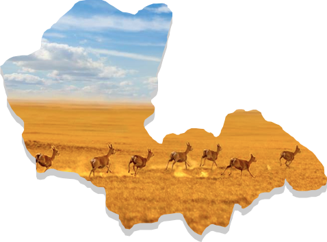
A major part of this province has steppe-light brown soil, while meadow-brown soil covers the northern and eastern part of the province. It is rich in steppe flora and considered as the most region with the most plentiful supplies of the resources for hay and pasture. This province is home to red deer, white antelope and Mongolian marmot.
Categories
Sukhbaatar
The Province has borders totaling 1,340km in length that are shared with the People’s Republic of China in the south (for 485 km), Dornogovi Province to the west (165km), Khentii Province to the north (260 km) and Dornod Province to the northeast (430km).
Sukhbaatar Province lies in the southern parts of the Great Eastern Plains of Mongolia and belongs to the steppe region. Most of the territory in the province is at an elevation of 1,000 to 1,200 m sea level. The highest point, Shillin Bogd Mountain, has an elevation of 1,778m while the lowest point, Baishint Region, has an elevation of 790m above sea level.
Sukhbaatar Province is considered to be a arid region with limited availability of surface water, with no rivers of constant flow. However, it does have about 20 small lakes, and 200 springs and streams, including Khavirgyn Bulag, [Talbulag], Aryn Nuur, Rashaant, Ereen Tolgoi, Dalai Bulag, Gashuun, Tsavchir, Uvdug, Modongiin Khudag, Tsagaan Bulag etc.
The province has many unique and scenic places. About 200 extinct volcanoes exist in Dariganga soum. The 127 to 248 km2 Ongon and Moltsog sand dunes stretch through the Dariganga and Ongon soum. The strictly protected Lkhanchinvandad Mountain is also located in this province in the Erdenetsagaan soum. The province has many caves including some 70 in Bayan Uul in Munkhkhaan soum, Bayandulaan and Talyn caves located in Naran and Dariganga soums. Ancient animal and plant fossils can be found in Baishint, Khodoodiin Govi, and Khorgoljingiin Tal, and vast areas exist with stone formations including Log, Budar, Zaraa, Turungu, Delgerkhaan and Khargiltai.
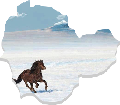
Mostly white antelopes and marmots inhabit the area. The area also contains species such as the Mongolian wolf, fox, steppe fox, badger, wildcat, skunk, rabbit, gopher, porcupine and black-tailed antelope. Khar Yamat area of Tumentsogt soum in the northern parts of the province, Lkhanchinvandad, Aratyn Mountain area of Erdenetsagaan soum in the southern parts are a home to a deer and a roe deer. Argali – the mountain wild sheep inhabits the rocks of Burentsogt.
The province is best known as the birthplace of Genghis Khan and one of first four provinces of Mongolia. It ccontains major part of the Khentii Mountain area and is located in the basins of Kherlen and Onon rivers. It shares borders with Dornod, Sukhbaatar, Dornogovi, Govisumber, Tuv, Selenge provinces and with Russia.
The Khentii Province was established in 1923. The province is listed as the ninth largest in Mongolia by geographical size and has an area of 80.300 km2.
The province is located in the north eastern region of Mongolia.
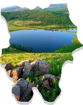
The west of the province contains the eastern part of the Khentii Mountains. The mountain Burkhan Khaldun in the Khentii Mountains is considered a sacred place by the state. The Onon river originates from the north of the Khentii Mountains, and the Kherlen river, crossing the front side of the province originates from the south of the Khentii Mountains.