Categories
east

Dornod

Dornod Province was established in 1931. It was originally named the Choibalsan Province after Communist leader Khorloogiin Choibalsan. This was changed to Dornod Province in 1963. Total territory of the province is 123,597 km2 and the capital is Choibalsan city.

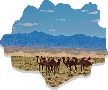
Dornod Province is located in the easternmost area of Mongolia. The province borders with Chita Oblast of Russia in the north and with China (Inner Mongolian Kulunbuir, Khyangan and Shillin Gol provinces) in the south. Within the country, it borders with the Sukhbaatar and Khentii provinces. Plain steppe dominates the entire province. The lowest point of Mongolia – Khukh Nuur (560 meters above sea level) is in this province.

Rocks and stones from the Paleozoic era, as well as the Jurassic and Cretaceous era and Neogon periods are widely found in this area. The rivers Kherlen, Onon, Ulz and Khalkh run through the province, as well as the lakes Buir, Khukh, Galuut and Yakhi. There are mineral springs such as Tsagaan Khund, Utaatminchuur, Ereen and Tsagaanchuluut.

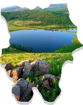
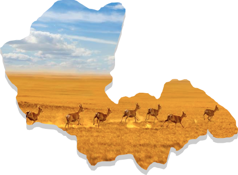
A major part of this province has steppe-light brown soil, while meadow-brown soil covers the northern and eastern part of the province. It is rich in steppe flora and considered as the most region with the most plentiful supplies of the resources for hay and pasture. This province is home to red deer, white antelope and Mongolian marmot.

https://mn.wikipedia.org/wiki/
Categories
east

Sukhbaatar

The Province has borders totaling 1,340km in length that are shared with the People’s Republic of China in the south (for 485 km), Dornogovi Province to the west (165km), Khentii Province to the north (260 km) and Dornod Province to the northeast (430km).

Sukhbaatar Province lies in the southern parts of the Great Eastern Plains of Mongolia and belongs to the steppe region. Most of the territory in the province is at an elevation of 1,000 to 1,200 m sea level. The highest point, Shillin Bogd Mountain, has an elevation of 1,778m while the lowest point, Baishint Region, has an elevation of 790m above sea level.

Sukhbaatar Province is considered to be a arid region with limited availability of surface water, with no rivers of constant flow. However, it does have about 20 small lakes, and 200 springs and streams, including Khavirgyn Bulag, [Talbulag], Aryn Nuur, Rashaant, Ereen Tolgoi, Dalai Bulag, Gashuun, Tsavchir, Uvdug, Modongiin Khudag, Tsagaan Bulag etc.

The province has many unique and scenic places. About 200 extinct volcanoes exist in Dariganga soum. The 127 to 248 kmOngon and Moltsog sand dunes stretch through the Dariganga and Ongon soum. The strictly protected Lkhanchinvandad Mountain is also located in this province in the Erdenetsagaan soum. The province has many caves including some 70 in Bayan Uul in Munkhkhaan soum, Bayandulaan and Talyn caves located in Naran and Dariganga soums. Ancient animal and plant fossils can be found in Baishint, Khodoodiin Govi, and Khorgoljingiin Tal, and vast areas exist with stone formations including Log, Budar, Zaraa, Turungu, Delgerkhaan and Khargiltai.

Mostly white antelopes and marmots inhabit the area. The area also contains species such as the Mongolian wolf, fox, steppe fox, badger, wildcat, skunk, rabbit, gopher, porcupine and black-tailed antelope. Khar Yamat area of Tumentsogt soum in the northern parts of the province, Lkhanchinvandad, Aratyn Mountain area of Erdenetsagaan soum in the southern parts are a home to a deer and a roe deer. Argali – the mountain wild sheep inhabits the rocks of Burentsogt.

https://mn.wikipedia.org/wiki
Categories
east

Khentii

The province is best known as the birthplace of Genghis Khan and one of first four provinces of Mongolia. It ccontains major part of the Khentii Mountain area and is located in the basins of Kherlen and Onon rivers. It shares borders with Dornod, Sukhbaatar, Dornogovi, Govisumber, Tuv, Selenge provinces and with Russia.

The Khentii Province was established in 1923. The province is listed as the ninth largest in Mongolia by geographical size and has an area of 80.300 km2.

The province is located in the north eastern region of Mongolia.

The west of the province contains the eastern part of the Khentii Mountains. The mountain Burkhan Khaldun in the Khentii Mountains is considered a sacred place by the state. The Onon river originates from the north of the Khentii Mountains, and the Kherlen river, crossing the front side of the province originates from the south of the Khentii Mountains.

https://mn.wikipedia.org/wiki
Categories
gobi

Dornogovi

This province is located in the southeast of Mongolia and share borders with the Umnugovi, Dundgovi, Govisumber, Khentii and Sukhbaatar provinces. The capital of the province is the city of Sainshand. Much of Dornogovi is located in the steppe of southeastern Mongolia. Despite this there are a number of mountain ranges including, Khutag (1,431 m), Otsol, Sansar, Ikh Bagadulaan, Argalant, Khan Bayanzurkh and Khairkhan (1,031 m).

The province is contained entirely within the Gobi zone and has an area combined with Gobi desert and steppe. It has harsh weather conditions, with temperatures reaching up to +410C during summer time and falling to -400C during winter time. Average wind speed is around 4.2 to 4.6 m/sec with occasional extremes of up to 35 m/sec.

Much vegetation can be found in this province. Black-tailed gazelles, Mongolian wild ass, Siberian ibex and mountain sheep are common. There are no large lakes or rivers in Dornogovi, instead there are many underground water resources. Mineral springs such as Khalzan Uul, Busiin Chuluu and Toli Bulag are located in this region. The major part of territory contains Gobi brown soil, and there are significant amounts of sand as well.

https://mn.wikipedia.org/wiki
Categories
gobi

Dundgovi

Dundgovi Province was established in 1941 under the name of Sharangad Province with total 18 soums. Of these, eight were transferred from Umnugovi Province, three from Dornogobi Province and 7 from Tuv Province. In 1942, the name was changed to Dundgovi, and the center of the province was moved to its current location Mandalgovi.

Dundgovi Province now has 15 soums, 66 bags and an area of 74,690 km2. It accounts for 4.5 percent of total territory of Mongolia. The capital Mandalgovi is located 265 km from Ulaanbaatar, and it shares borders with Tuv, Govisumber, Dornogovi, Umnugovi and Uvurkhangai provinces.

With a total border of 1,230 km, at its widest it is 425 km (Guchin Khudag to Khukh Del) and height north to south (Us Khar Hill to Uvur Tsagaan Ders) is 283 km. The territory contains steppe and Gobi desert zone. The highest point in plain steppe is at an elevation of 1,530 meters above sea level while the lowest point is 980 meters. The highest mountain – Delgerkhangai is 1,913 m. Mountain soil (dark brown, brown and light brown colored soil) is contained in a very small section of the province, found in the northern side of Adaatsag, Baga Gazriin Chuluu, Ugtaal Mountain and Ikh Gazriin Chuluu. The northern and central parts have hillocks and mound types of soil (brown, light brown, desertous steppe umber and Gobi-gray soil). In the southern and central parts, valley-type soil (20 types of soil from desert steppe) is widely found.

https://mn.wikipedia.org/wiki
Categories
gobi

Umnugovi

Umnugovi Province has a total area of 165,300 km2, containing 15 soums and 58 bags. The capital of the province is Dalanzadgad.

Umnugovi is the largest province in the country in terms of geographical size. The area is predominantly Gobi desert and has an average elevation ranging around 1,300-1,600m above sea level. There is however some continuance of the Altai Mountain range, with mountains of 3000m + elevation like Govi Gurvan Saikhan, Sevrei, Noyon Bogd, Nomgon, Tost, Nemegt, Altan Uul, Gilbent, and 100km long Khongor sand dune and couple dozen km vast Gobis like Galba, Borzon, Zeemeg, and Zag Sujiin.

The area has many springs such as Khadat, Nemegt, Zuulun, Enger Buleen and Talkhit cold springs, and the Elgen and Salkhit hot springs.

The steppe area in this province is rich in mineral resources like lead, copper, iron ore, marble, alabaster, feldspar and crystals. The province contains the Tavan Tolgoi deposit which holds several billion tons of high quality coal.

The province has extreme weather conditions. Temperatures range from -20 to 300C during winter and 30 to 380C during summer. The wind speed is 5 to 15m/sec with occasional bouts of 34 to 35m/sec.

https://mn.wikipedia.org/wiki
Categories
central

Gobisumber

By Resolution of the Consultative State Meeting on 21 June 1991, the city of Choir city was established as an integration of the Sumber and Shiveegobi Khoroos of the Dornogovi Province and the Bayantal Khoroo of Ulaanbaatar city. Subsequent to this, the Gobisumber Province was established on 6 May 1994. This Province surrounds the immediate area of Choir and is located 250 km south east of Ulaanbaatar.

The province shares borders with the Tuv Province to the north, the Khentii Province to the east and north east, the Dundgovi Province to the west and the Dornogovi Province to the west and south west. It has an area of 5,500 km2.

In meteorological terms, it experiences harsh continental weather, due to its combination of Gobi-desert and steppe environments. It is located at the altitude of 1,000-1,200 meters above sea level. Annual precipitation of Govisumber Province is higher than Gobi zone (200-250 mm in average) and has a temperature range of 370C in summer to -370C in winter. Govisumber Province is rich in mineral resources such as coal, mud for brick, mineral paint, fluoride, limestone and graphite.

https://mn.wikipedia.org/wiki
Categories
central

Darkhan-Uul

Darkhan-Uul Province has an area of 3,275 km2, covering the north-east valley of Kharaa River between branches of the Khentii Mountains in the northern part of Mongolia.

Despite its small geographical size, the province is rich in natural resources such as gold, limestone, coal and various types of raw materials used for construction products. It has an an average elevation of 707m and is thus located in relatively low area. Rivers including the Zulzaga, Shariin gol, Yuruu, Orkhon, Khuiten, Khavchuun and Kharaa river pass through the territory of this province, due to the Khentii Mountains and drain into Orkhon River.

Maximum temperature in the province is 42.60C in July and the minimum temperature is -43.7 0C in January. Annual average precipitation is 310 to 320 mm, of which, 85-90 percent or 284-290 mm of precipitation falls during the warmer months.

https://mn.wikipedia.org