Categories
central

Selenge

Selenge Province was established in 1934. It is located in northern Mongolia, between the Orkhon and Selenge river basins and is predominantly forest steppe region with hills and mountains. Jurassic era sediment deposits are spread throughout the northwest, granite is found throughout the south, and metamorphic granite throughout the north of the province. Selenge Province is rich in mineral resources such as coal (Ulaan Tolgoi, Sharyn Gol etc), iron ore (Tumurtei, Tumur Tolgoi), gold (Ikh Altat, Bugant, Tolgoit) and construction raw materials.

The large rivers of Mongolia such as Selenge, Orkhon, Yuruu and Kharaa flow through this region. There are also many lakes like Tsagaannuur and springs such as Yuruu, Tovkhonkhany, Khondyn, Mogoin. Most of the region has mountainous dark soil with some sediment soil in the river valleys. It is surrounded by Tavan Khan Mountain.

42 percent of the provinceincial territory is covered by forest and the remaining parts are covered by pasture plants. Rivers basins are covered by bushes. Forest and steppe animals are widely spread.

Categories
central

Tuv

The administration of this province was belonged to Ulaanbaatar between 1931-1942, however, this was changed to the current capital, Zuunmod in 1942.

Most of the territory of Tuv province has mountainous landscape, namely, the Khentii Mountain range at an elevation of 1,200 to 1,500m (the highest peak is Asralt Khairkhan at 2,800m). A total of 16.4 percent of all territory is forest, while 36.5 percent is steppe area.

The area of Tuv Province is considered as part of the Khentii-Khangai Mountain range and eastern Mongolian plains. The northern part of the province is covered with brown soil that is suitable for agriculture and in the southern part lays plains with small hills and mounds. There are more than 30 large and small rivers like Kherlen and Tuul. Also, there are springs such as Janchivlan, Tsaidam and Tsakhir.

16 species of endangered animals including deer, doe, moose, Argali –wild sheep, snowcock, swan etc. inhabit the area. About 30 different species of game animals like the squirrel, fox, marmot, steppe fox, boar, bear, and lynx also live in the area.

Categories
mountain

Arkhangai

he Arkhangai Province was originally established in 1923 under the name of Tsetserleg Mandal Uul Province, but was changed to Arkhangai Province in 1931. The province covers an area of 55,300 km2 and has an average altitude of 2,414 meters above sea level. The highest point is Kharlagtai Peak at 3,539m while the lowest point is the area on the confluence of the Orkon and Tamir rivers at 1,290 m.

The province is divided into three geographical zones: high mountain, forest steppe and steppe. It borders with Khuvsgul Province to the north, Bulgan Province to the east, Uvurkhangai Province to the south, Bayankhongor Province to the west and Zavkhan Province to the north-west. The province is an important area for tourism, with natural attractions including the Terkhiin Tsagaan Lake, Ugii Lake and the volcano landscapes Khorgo and Taikhar Chuluu.

The average annual temperature of Tsetserleg city is 0.10C, with a monthly average of -15.60C in January during the winter and 14.70C in July during the summer time. The Khangai mountains area has one of the highest precipitation levels in Mongolia, with average annual precipitation in Tsetserleg city of 344 mm. Average wind speed is 2.6 m/sec with a high of 3.5 m/sec in the month of April.

Categories
mountain

Bayankhongor

Bayankhongor Province was established by the Resolution #81 of Consultative State Meeting on 11 December 1941. It contains 16 soums, 112 bags, 11,800 households and a population of 41,800. With an area of 116,000 km2, it is one of the largest provinces in area, accounting for some 7.8 percent of the total territory of Mongolia. This includes four geographical zones: Altai, Khangai, Gobi desert and steppe. Bayankhongor Province is located in the central western part of Mongolia, at the transition from the Great Siberian taiga to the Central Asian Gobi desert. It borders with the Uvurkhangai, Umnugobi, Gobi-Altai, Zavkhan, and Arkhangai provinces and also share a 140km border with China. The center of the province is located 630 kilometers away from the capital, Ulaanbaatar.

The northern part of the province includes the plateau of southern Altai Mountains and forest steppe, the middle region includes the Great Lakes and steppe, while the southern part includes the Gobi desert zone. The province is known for its high capacity for solar and wind energy resources, despite harsh weather conditions ranging from the cold and wet weather of the north to the extreme dry conditions of the south. The majority of territory has an elevation of 1000-1400 m above sea level, with the lowest point, Ekhiin-Gol, located at the altitude of 720 m and the highest point, Ikh Bogd Mountain at the altitude of 3,957 m. Average temperature range is around -18 to 300C during the winter time and around 15 to 270C during the summer time.

The province is rich in minerals such as gold, copper, brown coal, crystal, spar, marble, granite and precious stone as well as construction materials like various soil paints, high quality mud and limestone.

Categories
mountain

Bulgan

The Bulgan Province was established in 1937 after a separation of certain areas from the Selenge Province. The province has 15 soums, a population of 43,500 and 1.1 million animals.

Located in central-northern Mongolia, the province share a 290km border with Khuvsgul Province, a 250km border with Arkhangai Province, a 30km border with Uvurkhangai Province, a 230km border with Tuv Province, a 220km border with Selenge Province and Orkhon province. It is also shares a 170km border with Russia. The province has harsh continental weather, an average annual temperate of 1.50C and annual average precipitation of 242.9 mm.

Bulgan city is the capital of the province and is located 318 km far away from Ulaanbaatar.

Seasonal difference In the winter there are often clear skies, cold but stable temperatures, low snowfall and weak wind speeds. Temperatures can reach -460C, typically in the month of January. Wind speeds are around 1.9 to 2.5 m/sec from the northern west. In the spring, the weather becomes moreunstable, with warm daytime temperatures and cold nights. There is also ahigh frequency of dust storm. In the summers, temperatures can reach as high as 40.50C. In autumn, there is a high variance temperature (to a lesser extent than spring). Unstable weather conditions and increase in wind strength in summer times.

Categories
mountain

Orkhon

This province was originally established as a federal municipality of Bulgan province in 1974 with the name of Erdenet Khoroo. This area would later be split from Bulgan Province and established as its own province in 1994 with a capital city Erdenet.

Orkhon Province is located in the central north of Mongolia and borders with Selenge and Bulgan provinces. It is has an average elevation of 1,200 meters above sea level and has an area of 844 km2.

Around 502 km2 of total territory is agricultural land, 251 km2 is city and settlement area, and the remaining area forest land. From agricultural land, around two-thirds are for crop fields and one-third is for pasture lands.

The province has harsh weather condition. Temperature can reach as low as -200C during winter and 300C during summer time. The annual average temperature is +0.80C and average precipitation is 371.8 mm in a year with high rain and snow fall. April and May are the windiest months, January is the coldest and July is the hottest month of the year.

Orkhon Province has two soums: Bayan-Undur and Jargalant, and these soums have 22 bags.

There are a total of 26 hotels with more than 300 beds and 9 recreational and tourism camps with the capacity of serving over 400 people in Erdenet city. In addition, there is “Mongol Urtuu” tourist network comprising of total 25 tourist camps and tour-operators in the Orkhon, Khuvsgul and Uvurkhangai provinces.

Categories
mountain

Uvurkhangai

The central geographical point of Mongolia is at the front side of Ongon Mountain, Burd soum, contained within the Uvurkhangai Province. The province is predominantly steppe in the central region, with the Branch Mountains of the Altai range and sandy steppe in the southern part, and with the branch mountains of the Khangai rabge in the northern part.

Since the province is divided into three distinct zones, it is rich with natural resources. There are plenty of high mountains and hills with elevations between 2,000-3,590m such as Khyatruun, Bituut of Khangai range, Bagabogd and Myangan Yamaat of Mongol-Altai range. Other highlights include the 24 meter high waterfall of Orkhon river named “Ulaan Tsutgalan”, the unique Khuisiin Naiman lakes and Tamchiin Yol Cliffs at an elevation of 2,500m above sea level. This as well as impressive steppes such as Arvaikheer, Shagj, Doloodoi, Khongor, Guchingiin Tal and Orkhon Valley lie in this province.

The northern part of the province contains the Branch Mountains of the Khangai range whereas the southern part is predominantly the steppe. The Bagabogd and Artsbogd mountains are found in this region. The central and northeastern parts of this province have an Early Mesozoic Era sandy stone and hornstones, while the southwestern part has Cretaceous Period moraines.

Rivers like the Orkhon, Ongi, Taats and Ar Agui flow through the Uvurkhangai Province. Large lakes like Ulaan Tsutgalan, Naiman Nuur and Taatsyn Tsagaan and numerous springs like Khujirtyn, Mogoit, Khyatruun, Khuremtiin, Taats, Mustiin, Khuren Khad, Khorkhoi Turuu and Takhiin, all belong to this province.

According to geological research, 4 gold deposits and 10 further detections have been established in this province, as well as 9 precious metal, 4 nonferrous metal, 2 iron ore, 4 mineral paint, one salt deposit and 12 construction material resource deposits.

Categories
mountain

Khuvsgul

Khuvsgul Province was established in 1931 and the name is derived from Lake Khuvsgul located within the area. It borders with Bulgan, Arkhangai and Zavkhan provinces, and also borders with Russia. Its capital Murun is located 671 km away from Ulaanbaatar. The province contains 24 soums and furthermore 126 bags in accordance with the constitution set in 1992. Total territory is 100.629 km2, and it is the sixth largest province in Mongolia in terms of geographical area. The province is dominated by the mountains and is rich in flora and fauna, mineral resources, abundant in historical and natural places, and a home to an untouched natural environment.

It is located in the Khangai Mountain Region. The major mountains are Khuvsgul Tagna and Sayan Mountains which belong to the Khangai Mountain range. The highest point of the province is the Delgerkhaan Mountain at 3,491m above sea level and the province has an average elevation of 1,650-2,050 m above sea level.

Categories
west

Bayan-Ulgii

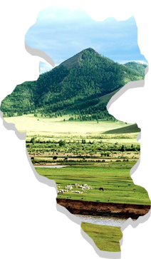
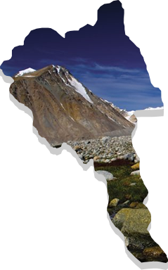
Баян-Өлгий аймаг нь 1940 оны наймдугаар сард БНМАУ-ын Бага Хурлын шийдвэрээр байгуулагдсан. Монгол Улсын хамгийн баруун хязгаар, далайн түвшнээс 1301-4374 метр өргөгдсөн бөгөөд мөнх цаст өндөр уулсаар хүрээлэгдсэн. Аймгийн төв нь Өлгий хот.

Газар зүй

Баян-Өлгий аймаг нь баруун талаараа Алтайн нурууны хяр дагаж БНХАУ-ын Шинжан-Уйгарын өөртөө засах оронтой 450 км, хойт талаараа Сийлхэмийн нуруу дагаж ОХУ-ын Алтайн БНУ-тай 225 км, зүүн талаараа Увс аймагтай 165 км, зүүн ба урьд талаараа Ховд аймагтай 450 км нутгаар хиллэдэг. Аймгийн газар нутаг нь далайн түвшнээс дээш 1301-4374 метр өргөгдсөн бөгөөд бүх нутаг дэвсгэрийн 95.3 хувь нь 1600 метрээс дээш өндөрт оршдог. Аймгийн нуруудын хамгийн өндөр цэг нь Монгол улсын хамгийн өндөр цэг болох Алтай Таван Богд уулын “Хүйтэн оргил “(4374 метр) ба хамгийн нам цэг нь Баяннуур сумын төв (1301 метр) юм.

Уур амьсгал

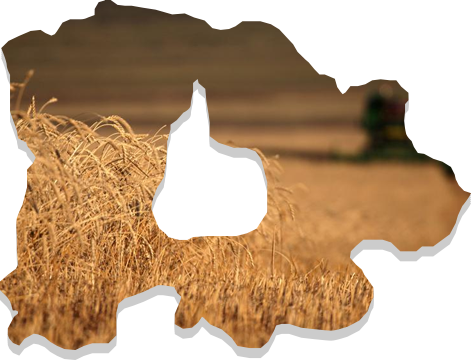
Аймгийн нутаг дэвсгэр нь дэлхийн бөмбөрцгийн хойт хагасын дундад өргөрөгт багтдаг учир эх газрын эрс тэс уур амьсгалтай. Далайн түвшнээс их өндөрт оршдогоос сэрүүн уур амьсгалтай, хүрээлэн оршдог өндөр уулс гаднаас агаарын урсгалаар ирсэн чийгийг биедээ татдаг учир Алтайн нурууны өндөрлөг хэсэгт хур тундасны жилийн дундаж хэмжээ 400-500 мм-д хүрдэг байна. Өөрөөр хэлбэл говь, цөлийн нөлөөнд ихээхэн автагдсан, өндөр уулын өвөрмөц уур амьсгал, эмзэг экосистемтэй. Салхины жилийн дундаж хурд 4-9 м/секунд хүрдэг.

Ургамал, амьтан

Агь, таана, хөмүүл, шаваг, шарилж , ерхөг, хиаг, хазаар өвс, харгана, хялгана, бударгана зэрэг хээр, цөлөрхөг хээрийн өвс ургамал зонхилж, чийг илүүтэй уулын сүүдэр хажууд үхрийн нүдхадгүзээлзгэнэтошлой зэрэг зэрлэг жимсгэнэ ургадаг. Ой нь уулсын зөвхөн сүүдэр хажууг бүрхэн, өвөр хажуугаар хээрийн ургамал тархсан, уулархаг нутгаар алтан гагнуур, чихэр өвс, бамбай, башиг, чийгийн давирхай, таван салаа, нохойн хошуу зэрэг эмийн ургамал ургадаг боловч үйлдвэрлэлийн аргаар өргөн ашиглаагүй байна.

300 гаруй сээр нуруутан байгаагийн дотор 11 зүйлийн хэвлээр явагч, 8 зүйл загас бүртгэгдсэн байна. Дэлхийд ховордсон аргаль, янгир, ирвэс, шилүүс зэрэг амьтдаас гадна чоно, үнэг, суусар, тарвага ,туулай, үен зэрэг ан амьтад, харцага, ёл, бүргэд, сар, тоншуул, хун, хотон, хойлог, алтан гургалдай, галуу, нугас зэрэг жигүүртэн шувуудтай.

Онцлог газрууд

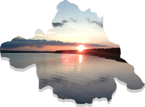
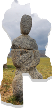
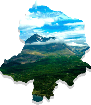
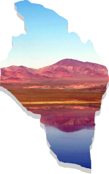
Байгалийн унаган төрхөө хадгалсан нутаг дэвсгэр нь мөнх цаст сүрлэг өндөр уулс, уудам хөндий нутагтай. Тэр дундаа Ёлтын сав газар, Потанины мөсөн гол, Бага ойгорын цагаан салаагийн хадны сүг зураг, Бага түргэний хүрхрээ зэрэг нь байгалийн үзэсгэлэнт газруудын нэг юм.

Эх сурвалж: http://www.bayan-olgii.gov.mn/pages/introduction

Categories
west

Govi-Altai

Говь-Алтай аймаг нь Монголын эзэнт гүрний үеэс түүх нь эхэлдэг бөгөөд засагт хан, Хантайшир уулын аймаг, дахин засаг хан аймаг болоход үндсэн бүрэлдэхүүн хэсэгт нь багтаж байсан бөгөөд 1940 онд улсын бага хурлын тэргүүлэгчдийн 45 дугаар тогтоолоор Говь-Алтай аймаг болж одоогийн нутгийн хилийн цэсээр тогтоон байгуулагдсан түүхтэй. Аймгийн төв Алтай хот нь манай улсын хамгийн өндөрт оршдог аймгийн төв бөгөөд далайн түвшнээс дээш 2181м өндөрт оршдог.

Газар зүй

Говь-Алтай аймаг Монгол Улсын баруун зүгт зүүн талаараа

The Govi-Altai Province is located in the west of Mongolia and its capital, Altai is around 1,001 km distance from Ulaanbaatar. It has a wide area covering 141,400 km2, with combination of high mountains and Gobi steppe. Its length north to south is 600 km and its width is 400 km. The province is the second largest in Mongolia. It shares borders with China to the south and south west, Khovd province to the west, Zavkhan province to the north and Bayankhongor to the east. The highest point is Suitai Khairkhan Mountain, at 4,090 meters above sea level while the lowest point is Zagt Ikh Sair of Tsenkher Nomin’s Gobi at 802 meters above sea level.

Altai is the highest province capital in Mongolia, located at a height of 2,181 m.

There are 29 species of fauna in the province, as well as 8 species of antelope including Przewalski’ horse (takhi), Mongolian wild ass (Khulan), wild camel, mountain sheep (argali), Siberian ibex, saiga, goitered gazelle and deer. There are also five 5 predator species such as the Gobi bear (Mazaalai), leopard, sable, marten and otter, as well as birds including swan, pheasant, pelican, snowcock, bearded vulture, cinereous vulture, buzzard, boreal owl, barred owl, eagle owl and woodpecker.